
Tumbling Creek Cave
Available Journals
A National Natural Landmark
References on
Tumbling Creek Cave
Field Trips &
Professional Short Courses
Contact Information
Protecting the Cave &
its Ecosystem
Help Needed
Please Donate Now!
Tumbling Creek Cave
Tumbling Creek Cave is located in rural southeastern Taney County, Missouri about 35 miles east of Branson and 75 miles southeast of Springfield. It contains approximately two miles of mapped passages, many of which are highly decorated with speleothems including stalactites, stalagmites, columns, flowstone, and cave coral. Some of the beauties of the cave are shown in a 12-page photo essay in the Time-Life book “The Ozarks” in the American Wilderness Series (Rhodes 1974). Among the more spectacular features in the cave is the Big Room, which is 60 feet high and 170 feet directly below the crest of Cave Ridge.
While there are many beautiful and spectacular caves in the United States, the use of Tumbling Creek Cave is unique. The cave is a critical component of the Ozark Underground Laboratory, a research and education field center founded in 1966. Since its establishment about 30,000 people (mostly college students) have been guided through the cave on educational field trips. More information on field trips is found under the heading “Field Trips and Professional Short-Courses”. In addition, many research projects have been conducted (see references) or are currently in progress in the cave.
Tumbling Creek is the name of the underground stream that flows through the cave. Over 60 groundwater traces using fluorescent tracer dyes have been used to delineate the 9.02 square mile recharge area that contributes water to the cave. The recharge area is shown in Figure 1. While all mapped cave passages are in the Big Creek topographic basin, about 70% of the recharge area for the cave lies to the west in the Shoal Creek topographic basin. The cave stream responds quickly to rainstorms and flow rates of as much as 100 million gallons per day have occurred within the cave. Under low flow conditions all the flow emerges from a few springs tributary to Big Creek. Under high flow the cave stream feeds 15 to 20 springs (depending upon how one counts nearby springs) located along Big Creek and the lower portions of Bear Cave Hollow.
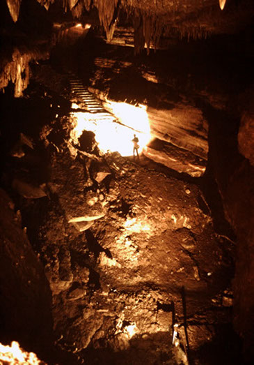
Figure 1. Recharge area for the cave. Bull Shoals Lake extends into the area shown in purple.
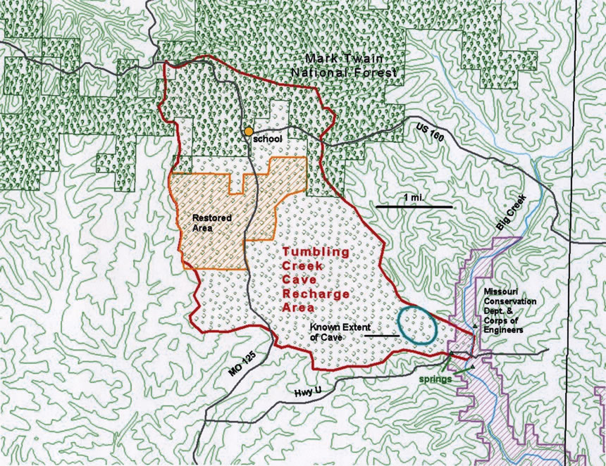
Map courtesy of Missouri Department of Conservation.
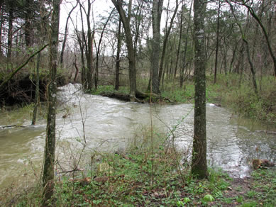
Much of the flow of Tumbling Creek is derived from losing streams on the surface. These streams, including Bear Cave Hollow, Sinking Creek, and Pelham Hollow, flow appreciable amounts of water only during major storms. During one storm event tracer dyes were introduced upstream of sinking points in Sinking Creek and Pelham Hollow and were subsequently detected 14.5 hours later in the cave stream 2.4 miles away from the sinking points. This represents a mean straight-line groundwater travel rate of 880 feet per hour, which contrasts dramatically with the slow groundwater travel rates reflective of many non-karst aquifers. The longest distance groundwater trace into the cave was from a losing stream 5.3 miles away.
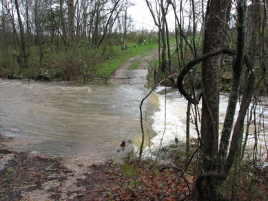
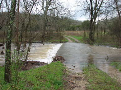
The Stream photos above show the combined flow of a third of these springs during a stormflow. The photo below shows the flow from the Bear Cave entrance during a stormflow.
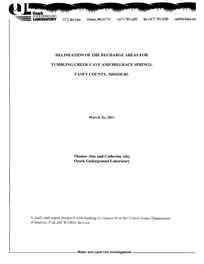
“Delineation of the recharge areas for Tumbling Creek Cave and Millrace Springs,
Taney County, Missouri” dated March 26, 2001.
Many of the studies conducted in Tumbling Creek Cave have focused on the movement of water into and through the cave system. These have included groundwater tracing studies using fluorescent tracer dyes to accurately delineate the recharge area for the cave; the recharge area is the area that contributes water to the cave. Some of the techniques routinely used in groundwater tracing studies throughout the United States were developed and tested in the recharge area for Tumbling Creek Cave.
Other water studies have assessed travel rates for water to move from the land’s surface into stalactite drippage zones and the seasonal variability in water chemistry and flow rates of these drippage waters (Fair 1974). One study examined correlations between land use in losing stream basins and water quality in the cave (Neill 2003 and Neill et al. 2003). A study begun in 2009 is examining the movement of stream cobbles in the cave stream and comparing this with similar measurements made on the surface stream in Bear Cave Hollow.
A substantial number of biological studies have been conducted in Tumbling Creek Cave. These have included:
-
Frequent census work of the summer gray bat (Myotis grisescens) population using the cave. Much of this work by the Missouri
Department of Conservation (MDC) used infra-red filming of the
emergence flights and, more recently, a sophisticated
computerized thermal tracking system The monitoring is conducted
at the gate on the Bear Cave entrance to the cave system. The
gate was constructed with funding from MDC.
- Extensive monitoring of Tumbling Creek Cavesnail (Antrobia culveri) populations has been conducted by Dr. David Ashley of Missouri Western State University. This is a federally-listed endangered species found only in Tumbling Creek Cave.

Installation of facilities for captive propagation of the Tumbling Creek Cavesnail.
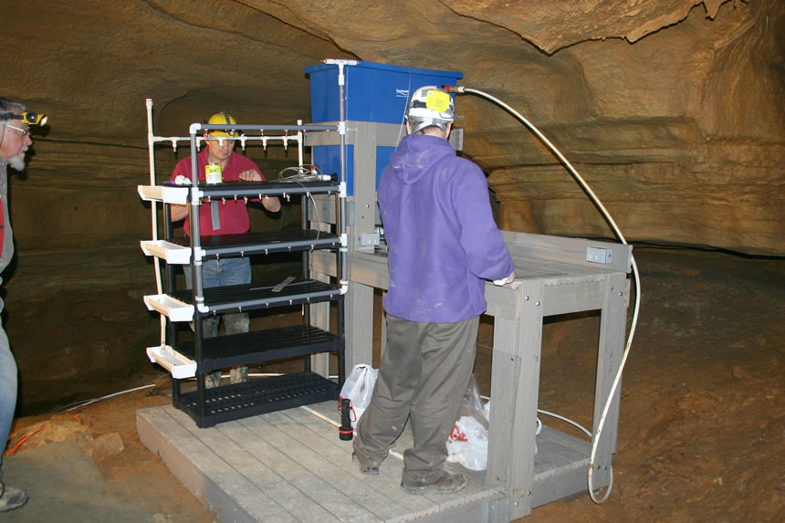
Photo courtesy of Bill Elliot
© 2009 Tumbling Creek Cave Foundation
Website Design by Babcock Illustration and Design
Protem Missouri